
Scotland 2012
We arrived at the cultural centre of Scotland after a thirty-hour flight from New Zealand to Germany, with a layover in Frankfurt that lasted more than six hours. The Scots have concluded that I must be some sketchy guy attempting to bring extra batteries into their nation. They cut the luggage's locks and removed the offending item. We finally departed the airport and boarded a bus to the heart of the city. In close proximity to Edinburgh Old Town, we stayed at the Premier Inn at 82 Lauriston Place. We were so jet-lagged that straight after shower we went to bed and not even the saturday's revelers could keep us awake.
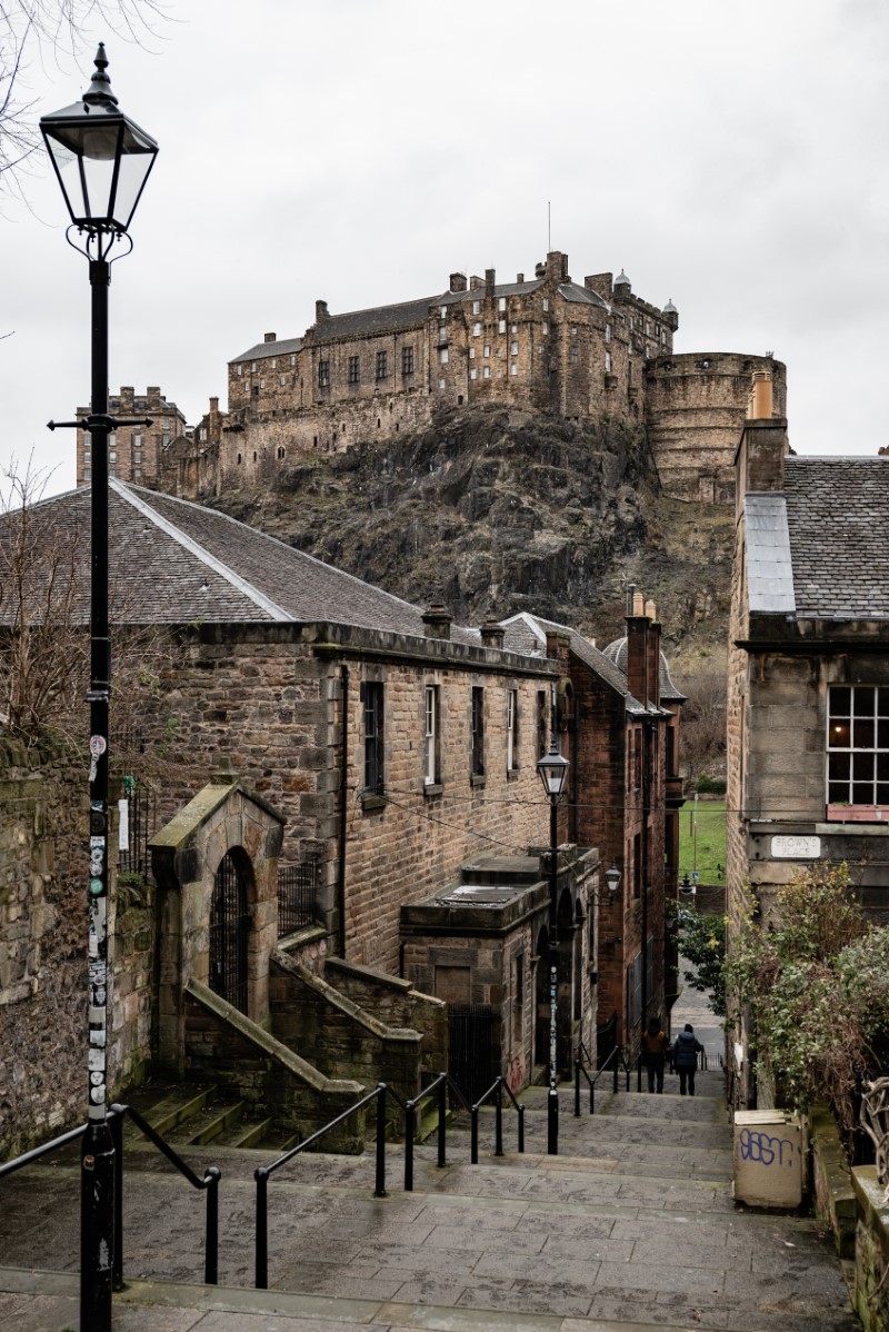
Day 01
An early breakfast that included many teas and black coffees got us ready for the day and helped with the
jet lag issue. We were interested in knowing where the Rabbie's departure point was as we would be
walking there the next morning for our bus excursion. Of course, we also wanted to visit as much of the
historical Edinburgh as we could in a single day. To assist us with this task, we went on a free city tour,
where you pay the guide what you believe is suitable at the conclusion of the walks. And indeed we managed
to see a big part of old town.
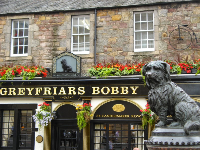
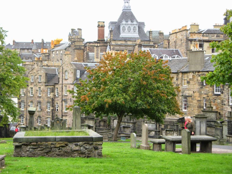
• While touring Greyfriars Kirkyard we learn about body snatchers
and
Greyfriars Bobby, a Skye Terrier who spent 14 years watching over his master's grave.
We saw the Scott (Sir Walter Scott) Monument next to the Scottish National Museum, learned the meaning of
the phrase 'Shit Face', and saw the Elephant House where J.K. Rowling composed the first draughts
of Harry Potter. We indulged ourselves in delicious pulled pork sandwiches from Oink Hog Roast on Victoria
Street. Some of us even had double pork crackling while others didn't.
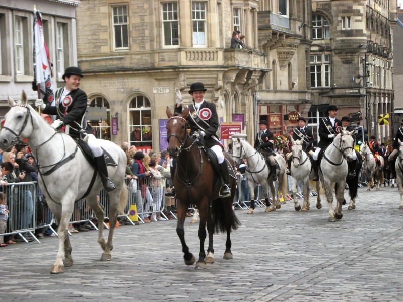
• We spent the
majority of
the afternoon surrounded by hundreds of fans watching the Riding of the Marches. The seven-hour trip from
the Braid Hills to the city, terminating at the Mercat Cross on the Royal Mile, is a historic event dating
back to the 16th century.
Day 02
Doune Castle - This morning, we met our tour leader and a group of friendly individuals
from all over the world who were all eager to experience the Scottish Highlands and Islands. We left
Edinburgh in a van driven by our tour guide. We were on our way to Doune Castle, our first stop.
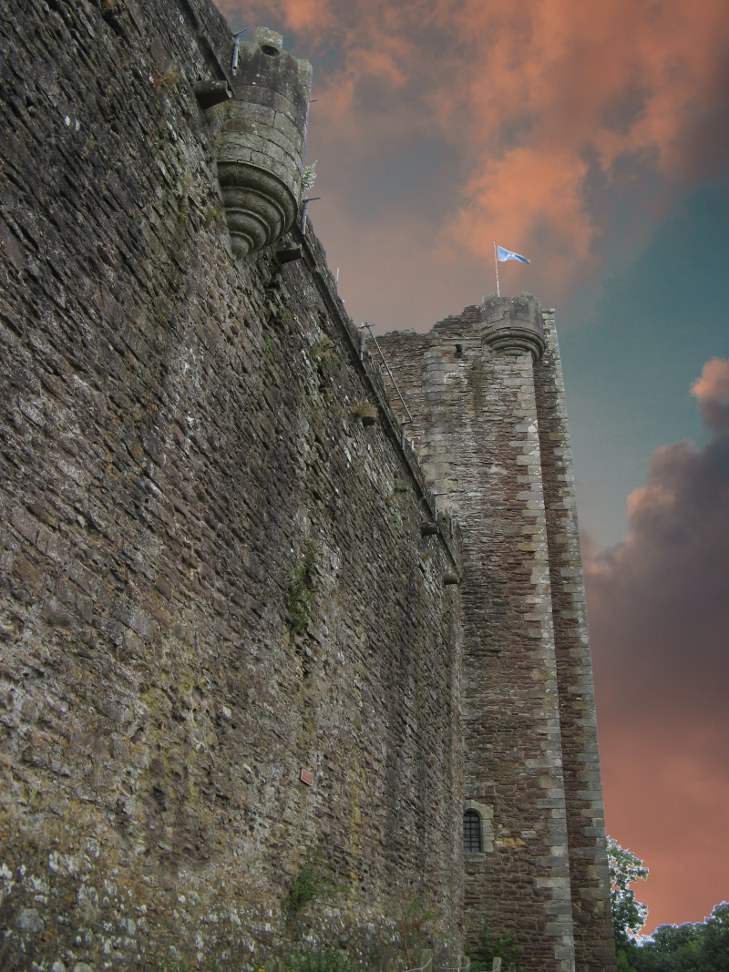
Doune
was the seat of Robert Stewart, the 1st Duke of Albany and Governor of Scotland. He acquired the castle in
1361, when he married Margaret Graham, Countess of Menteith. Doune only officially became a royal castle
after the death of both Albany and his son Murdoch, who was executed by James I on his return to Scotland in
1424. Doune provided secure lodgings, but it seems neither as well organised nor as comfortable as Edinburgh
Castle or Stirling Castle. Doune's role as royal retreat effectively came to an end in 1603, when James
VI left for London, to become James I of England.
Falls of Dochart - We stopped for morning tea at Callander, a little town near Doune.
We bought some sausage rolls from the local bakery and went for a walk along the main, if not the only,
street.
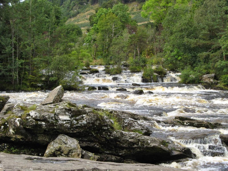
After a brief rest, we proceeded on to Killin, a little village in the Loch Lomond and The
Trossachs National Park. The Falls of Dochart, a cascade of waterfalls, are famous in the area. The Dochart
Bridge, built in 1760, spans the river at Killin, providing a view of the falls as they flow over the rocks
and across the island of Inchbuie, the ancient burial place of the MacNab clan.
This location will be
remembered not just for its beauty, but also for the worst cup of black coffee I've ever tasted.
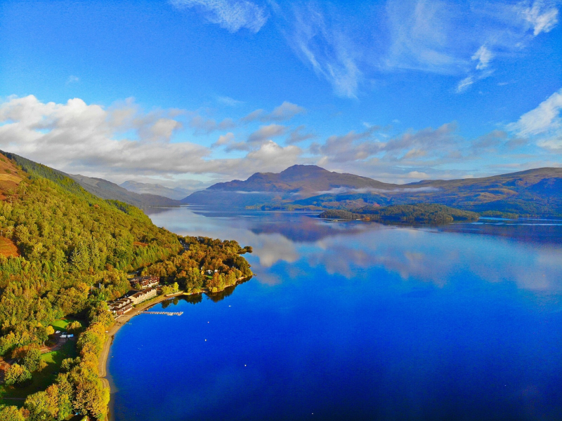
Loch Lomond - The National Park of Loch Lomond and The Trossachs was the next stop. It is a picturesque area located in central Scotland, known for its breathtaking landscapes, rugged mountains, and stunning lochs (lakes). It was established in 2002 and covers an area of approximately 1,865 square kilometers (720 square miles). The park is named after its two main features: Loch Lomond, which is the largest freshwater lake in mainland Britain, and the Trossachs, a scenic area of forests and glens. One of the highlights of Loch Lomond and The Trossachs National Park is the iconic Loch Lomond itself, with its stunning scenery and numerous islands. Visitors can enjoy boat cruises, kayaking, and hiking along the loch's shores, or simply take in the panoramic views from various viewpoints. The park is also known for its diverse wildlife, including red deer, ospreys, golden eagles, and many other bird species.
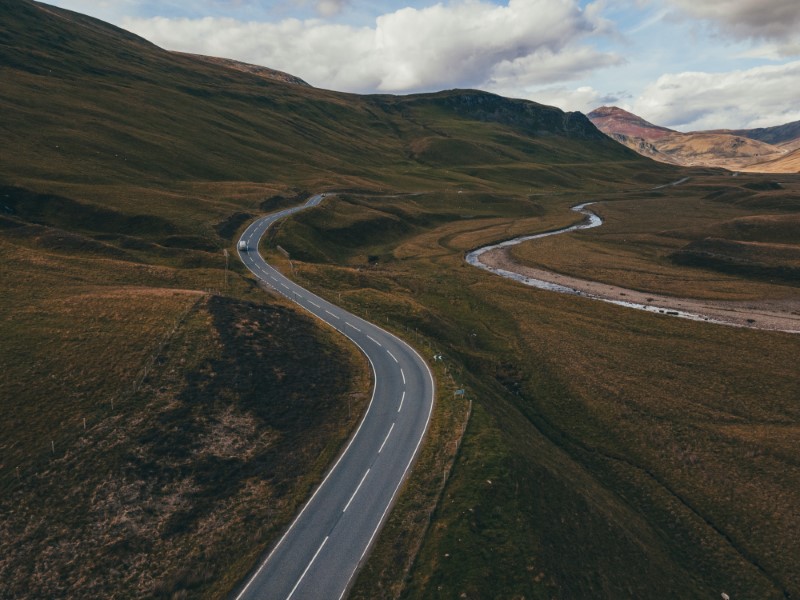
Inveruglas - Glen Croe - Old Military Road - The last stop before arriving in Inveraray was
at the Rest and Be Thankful Viewpoint on the historic Military Road.
Glen Croe, also known as "The Rest
and
Be Thankful," is a steep glen located in the Arrochar Alps, a mountain range in the Scottish Highlands. The
glen is famous for its dramatic scenery, with rugged mountains, dense forests, and a winding road.
The
Old Military Road, also known as the A83, is a historic road that runs
through Glen Croe in Argyll and Bute, Scotland. It was originally built in the 18th century by the British
military as a strategic route for moving troops and supplies through the Highlands.
Inveruglas is a small village situated on the eastern shore of Loch Lomond, which is the largest freshwater
lake in Scotland.
The combination of Inveruglas, Glen Croe, and the Old Military Road makes for a
stunning and picturesque drive through the Scottish Highlands, offering breathtaking landscapes and
opportunities for outdoor recreation and sightseeing.
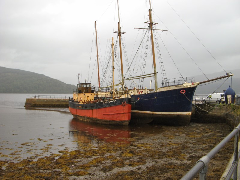
Inveraray - We had our first Scottish pub meal at Inveraray's famed George Hotel. The
George Hotel is a historic landmark located in Inveraray, a picturesque town in western Scotland. The hotel,
which dates back to the 18th century, is renowned for its grandeur and rich history, making it a popular
destination for travelers and history enthusiasts alike. The George Hotel was originally built in 1770 by
Archibald Campbell, the 3rd Duke of Argyll, and has been a
prominent fixture in Inveraray ever since. The hotel's architecture is a fine example of Georgian style,
with its elegant facade, tall windows, and ornate detailing.
Inveraray itself is a small town located in
Argyll and Bute. It is situated on the western shore of Loch Fyne, a sea loch that stretches from the west
coast of Scotland into the Scottish Highlands. Inveraray is known for its picturesque setting, historic
architecture, and as the ancestral home of the Duke of Argyll, who resides in Inveraray Castle. Inveraray is
also known for its historic architecture, with many well-preserved Georgian buildings lining its streets.
The town has a picturesque waterfront area, with views of the loch and surrounding hills. There are also
shops, cafes, and restaurants offering local products and cuisine, making Inveraray a pleasant place to
explore and experience Scottish culture.
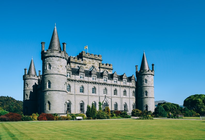
Inveraray Castle - The flag was up, indicating that the Duke of Argyll was at home, and we could only see the castle's exterior. It is the ancestral home of the Duke of Argyll and the seat of the Clan Campbell, one of the most prominent Scottish clans. Inveraray Castle is renowned for its beautiful architecture, stunning gardens, and rich history. Construction of Inveraray Castle began in 1746, and it was completed in the 1780s. The castle was designed by renowned architect Roger Morris and incorporates both Gothic and Palladian architectural styles, making it a unique and visually striking structure. It is built with greyish-blue stone quarried from nearby mountains, giving it a distinctive appearance. One of the highlights of Inveraray Castle is its extensive gardens and grounds. The castle is surrounded by picturesque gardens that include a walled garden, a woodland walk, and a fernery. The gardens are known for their beauty and are meticulously maintained, with carefully cultivated flowerbeds, tree-lined pathways, and stunning vistas of the surrounding countryside.
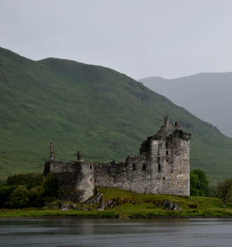
Kilchurn Castle - We arrived at the Kilchurn Castle Viewpoint and Layby after a short ride
and enjoyed a glimpse of the castle. Kilchurn Castle is a historic ruin located in the Highlands of
Scotland, on the northeastern shore of Loch Awe. It is a picturesque castle that dates back to the 15th
century and is known for its stunning setting amidst the Scottish landscape.
Kilchurn Castle was built
by Sir Colin Campbell, the first Lord of Glenorchy, in the mid-15th century as a strategic stronghold for
his clan. The castle was strategically positioned on a peninsula, which provided a defensible location with
natural defenses on three sides, including the lake on one side and marshy ground on the other two sides.
Over the centuries, Kilchurn Castle was expanded and modified by successive generations of the Campbell
clan, and it served as a symbol of their power and influence in the region. The castle has a unique
architecture, with a combination of medieval and Renaissance styles. It features a four-story tower house
with a courtyard, along with various other buildings such as a chapel, a great hall,
and a gatehouse. The castle was originally accessed by boat, and a drawbridge provided entry across the
moat. Kilchurn Castle played a significant role in the history of Scotland, including the various conflicts
between the Campbell clan and their rivals, as well as the larger political and military struggles in the
region. However, by the 18th century, the castle had fallen into disrepair, and it was abandoned by the
Campbells. Today, Kilchurn Castle is managed by Historic Environment Scotland, and it is open to visitors
who can explore its ruins, learn about its history, and enjoy the stunning views of Loch Awe and the
surrounding mountains. It is a popular tourist attraction and a favorite spot for photography enthusiasts
due to its picturesque location and atmospheric ruins.
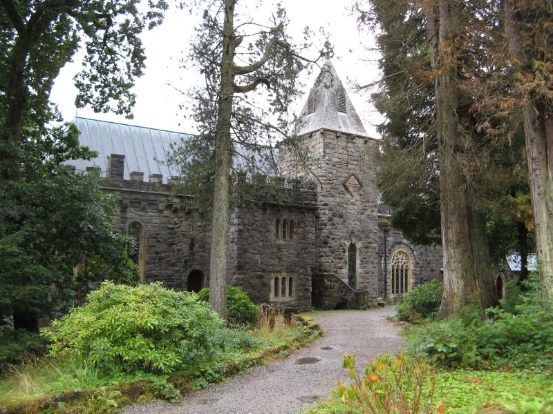
St Conan's Kirk - Our final stop before arriving in Oban was a little chapel on the shores of Loch Awe. St Conan's Kirk is a unique and stunning example of Victorian Gothic architecture, designed by architect Walter Douglas Campbell and built between 1881 and 1930. St Conan's Kirk is known for its elaborate and intricate detailing, incorporating elements from various architectural styles, and its picturesque location overlooking the loch. One of the most striking features of St Conan's Kirk is its tower, which is modeled after the famous Holyrood Abbey in Edinburgh. The tower houses a working clock and a set of chimes that play a different tune every day of the week. The interior of the church is equally impressive, with beautiful stained glass windows, ornate woodwork, and decorative stone carvings. The church also has a number of interesting historical artifacts, including a replica of the famous Celtic Cross of Iona, as well as a marble baptismal font dating back to the 12th century. The churchyard contains the graves of several notable individuals, including members of the Campbell family, who were the patrons of the church.
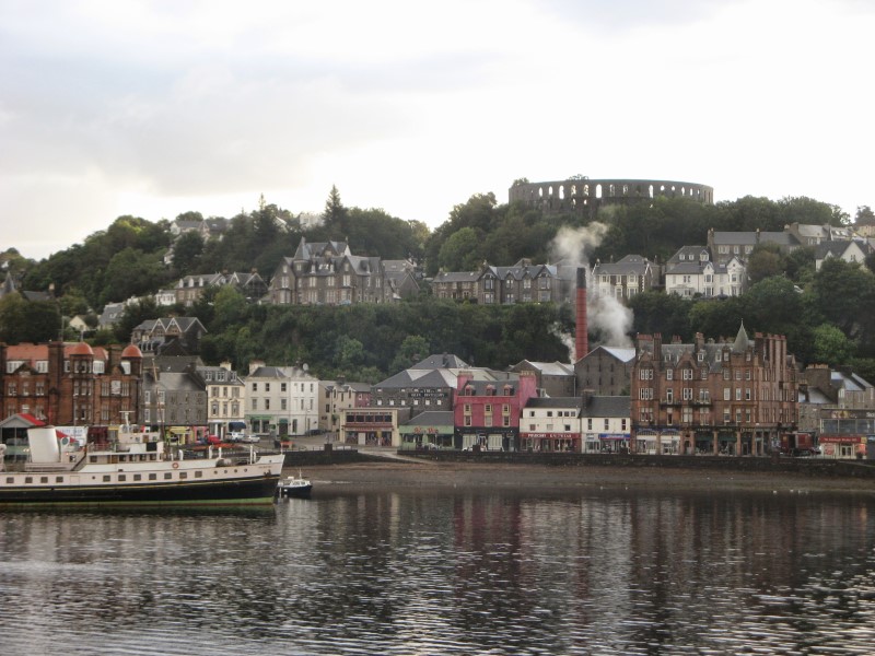
Oban - We were relieved to arrive at our B&B, No17 The Promenade in Oban, after more
than nine hours on the road and a distance of 277 km. Oban is located on the west coast of Scotland. It is
situated on the shores of the Firth of Lorn, a narrow sea inlet, and is surrounded by beautiful hills and
islands. It is a popular transportation hub, serving as a gateway to the Hebridean islands. It is known as
the 'Gateway to the Isles' due to its ferry connections to the islands of Mull, Coll, Tiree, and
others. Oban also has a railway station that connects it to Glasgow and other parts of Scotland.
After
taking a short look at our B&B accommodation, we went for a stroll around Oban's streets in search of a
restaurant that served meals and beverages. We eventually enjoyed a supper and a few drinks at the Oban Inn
before retiring to our lodgings and preparing for the next day's excursion.
Day 03
Mull - The Isle of Mull is a picturesque island located off the west coast of Scotland,
known for its stunning landscapes, diverse wildlife, and rich history. It is the second-largest island of
the Inner Hebrides.
Our first stop on the Isle was a lookout above the The Three Lochs, also known as Loch na
Keal, Loch Ba, and Loch Beg. The Three Lochs are three interconnected sea lochs located on the western coast
of the Isle. These lochs are known for their scenic beauty, with rugged
mountains, lush forests, and abundant wildlife. Loch na Keal is the largest of the three lochs and is home
to various species of seals, otters, and seabirds.
The quickest method to go from Mull to Iona is to take a small boat from Fionnphort.
Fionnphort is a small village located on the southwestern tip of the Isle of Mull. It
serves as a popular gateway to the nearby Isle of Iona. Fionnphort is also known for its beautiful sandy
beaches, rocky shores, and stunning views of the surrounding islands.
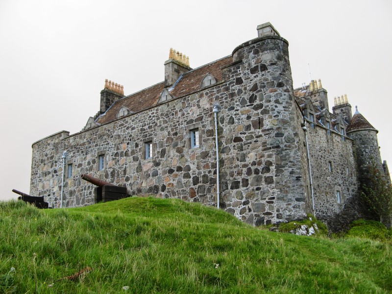
On our way back from Iona, just before boarding the ferry, we stopped at Duart Castle.
Duart Castle is a historic castle located on the eastern coast of the Isle of Mull. It is
one of the most
iconic landmarks on the island and is known for its striking medieval architecture and stunning coastal
location. Duart Castle dates back to the 13th century and has been the ancestral home of the Clan Maclean
for centuries.
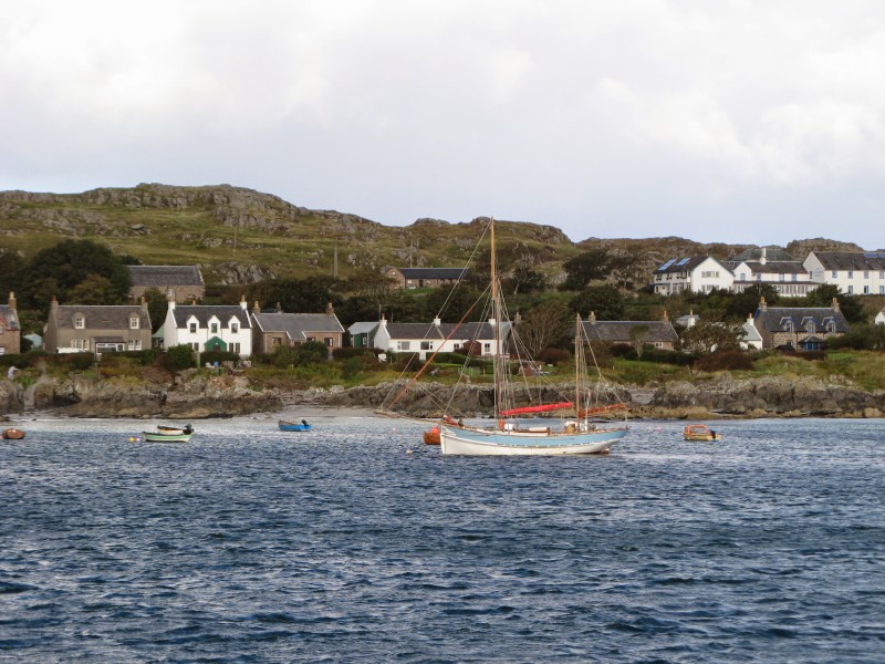
Iona - Iona Island is a small island located off the west coast of Scotland, in the Inner Hebrides. It is known for its historical and spiritual significance, as well as its natural beauty. Iona Island has a rich history dating back to ancient times, with evidence of human occupation for thousands of years. In the 6th century, the island became an important center for Christianity when St. Columba, an Irish monk, established a monastery on Iona. The monastery, known as Iona Abbey, became a significant religious and cultural hub, producing important religious texts and spreading Christianity throughout Scotland and beyond.
Day 04
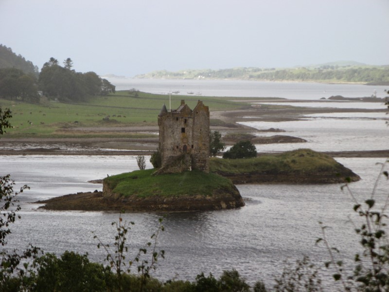
We traveled from Oban to Castle Stalker early in the morning. Castle Stalker is a
picturesque castle located on a tidal islet in Loch Laich, near Appin. The castle is a four-story tower
house, believed to have been built in the early 14th century by Clan MacDougall. It later passed into the
ownership of Clan Stewart, and has been associated with several prominent Scottish families over the
centuries. The castle has served various purposes throughout its history, including as a defensive
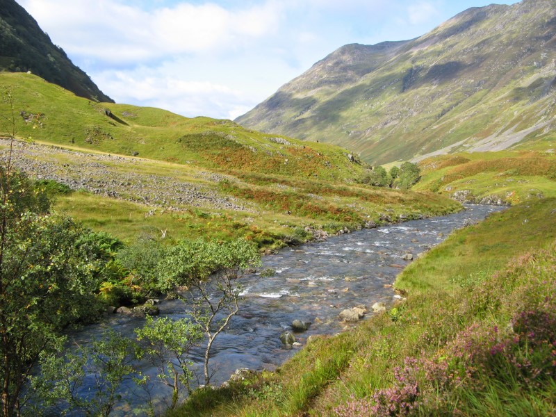
structure, a hunting lodge, and a family residence. Next stop, Glen Coe. Glen Coe is
a scenic valley
located in the Scottish
Highlands, often considered one of the most beautiful and iconic glens in Scotland.The glen has a rich
history dating back thousands of years, with evidence of human habitation and
activity in the area since prehistoric times. It is also associated with the infamous Glencoe Massacre,
which occurred in 1692 when members of the MacDonald clan were massacred by soldiers loyal to the
British Crown. We returned from the Coe to the Last Clansman Memorial and continued on our
way to Port William and Inverlochy Castle
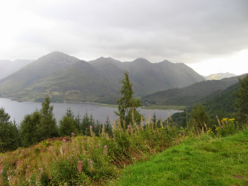
We paused on the way down to
the Shiel Bridge to photograph the Five Sisters of Kintail, a
mountain range located in the Scottish Highlands. The range is known for its distinctive peaks that resemble
five sisters standing side by side, hence the name "Five Sisters of Kintail".
We took the old Gleng-Isle of Skye Ferry to Skye Island. The Glenelg-Isle of Skye ferry is
a small vehicle and passenger ferry that has been in operation for over 70 years, providing a unique and
picturesque way to access the Isle of Skye. The ferry journey takes approximately 5-10 minutes, depending on
weather conditions, just enough time to hear the famous tv license's inspector story, and provides an
alternative route to Skye compared to the Skye Bridge.
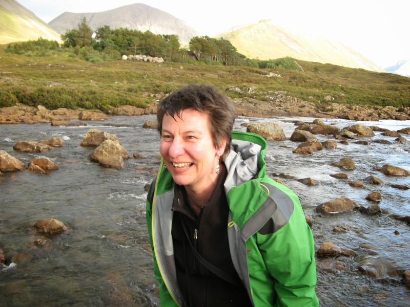
The Slingachan Bridge was our
final visit before arriving in Portree, the largest settlement on the Isle of Skye. Sligachan is a small
settlement located in the central part of the Isle of Skye, known for its picturesque scenery and its
historic Sligachan Bridge, which spans the River Sligachan. The area around Sligachan is known for its
stunning landscapes, including the majestic peaks of the Cuillin Mountains, which are a popular destination
for hikers and mountaineers. The magical waters by Sligachan Bridge refer to the river that flows underneath
the bridge, which is believed by some to possess mystical or supernatural properties. According to local
folklore, the waters of the River Sligachan are said to have healing properties and are associated with
various legends and stories. One of the legends is that the waters of the River Sligachan have the power to
grant wishes. It is said that if you make a wish while standing on the bridge and throw a stone into the
river, your wish may come true. This is similar to the stone throwing tradition mentioned earlier, where
visitors would skip stones across the water as a form of making wishes or blessings. Another belief
associated with the magical waters of Sligachan Bridge is that they possess a rejuvenating or
revitalizing quality. Some believe that splashing or immersing oneself in the river can have a purifying
effect, revitalizing the mind, body, and spirit.
Day 05
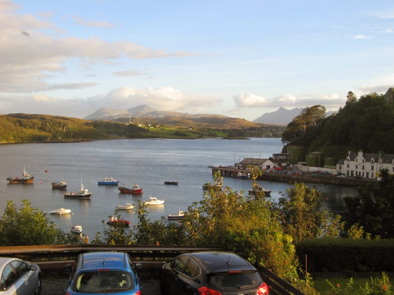
A delicious breakfast at our B&B across from Portree Harbour, given by a friendly European lady, provided a
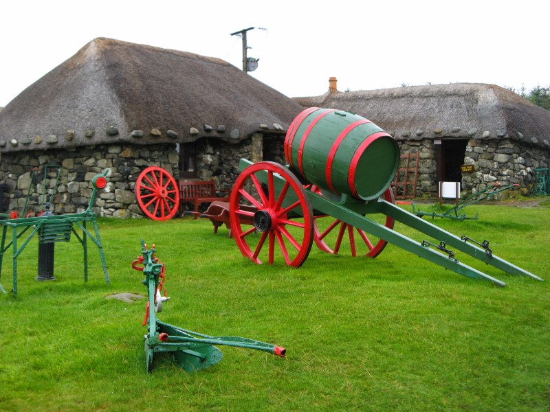
good start to the busy day. The day's itinerary included stops to Staffin, Skye Museum of Island Life,
Dun Beag Broch, and St. Columba's Isle.
Staffin is a small village located on the northeastern coast of the Isle of Skye
and is known for its stunning natural scenery, including towering cliffs, scenic beaches, and unique rock
formations. One of the most famous landmarks in Staffin is the Trotternish Ridge, which features iconic rock
formations such as the Old Man of Storr and the Quiraing. The village is also known for
its dinosaur fossils, with the Staffin Dinosaur Museum showcasing the remains of dinosaurs that once roamed
the area millions of years ago.
Skye Museum of Island Life features a diverse collection of exhibits that provide insights
into the island's past, including its ancient geological formation, early human settlement, medieval
history, clan culture, and more. The museum's exhibits include artifacts, photographs, maps,
interactive displays, and multimedia presentations that offer a comprehensive overview of Skye's
heritage and traditions.
Dun Beag Broch was built during the Iron Age, likely around 2,000 years
ago. It is believed to have been inhabited by a single family or a small community and served as a fortified
dwelling, providing protection from external threats. Dun Beag Broch is a circular tower made of dry stone
construction, without the use of mortar. It has a diameter of about 9 meters and stands approximately 9
meters tall, with walls that are up to 5 meters thick at the base. The entrance to the broch is through a
narrow passage and a doorway that leads into the central courtyard.
St. Columba's Isle is a small island located in the Inner Hebrides. It is named after
St. Columba, a Christian missionary and abbot who played a significant role in spreading Christianity in
Scotland and Ireland during the 6th century. It is believed to have been a place of worship for early
Christian settlers in Scotland, and it is said that St. Columba himself visited
the island and established a monastic community there in the 6th century. The island is associated with
several legends and miracles attributed to St. Columba, and it is considered a holy site by many Christians.
Day 06
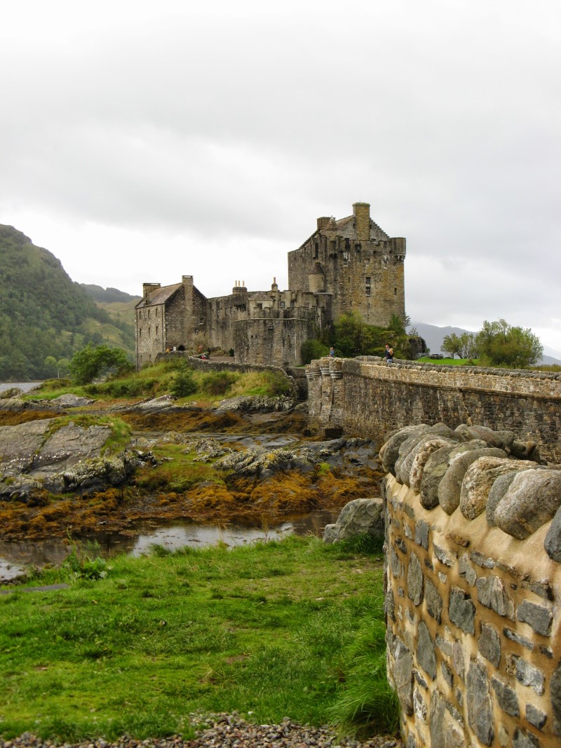
Eilean Donan Castle (in New Zealand referred to as Fiona's Castle) is a picturesque
castle located in the western Scottish Highlands, on a
small island known as Eilean Donan, which is connected to the mainland by a bridge. The castle is situated
at the meeting point of three lochs: Loch Duich, Loch Long, and Loch Alsh, making for a stunning and
dramatic setting.
Eilean Donan Castle is one of the most iconic and recognized castles in Scotland,
known for its unique architecture and historical significance. The castle has a complex history that dates
back to the 13th century when a fortified structure was first built on the island. Over the centuries, it
was expanded and modified by different clans and families who owned it, including the MacRae and MacKenzie
clans. It served as a strategic stronghold during various conflicts in Scottish history, including the
Jacobite uprisings.
The castle fell into ruin by the 18th century and remained abandoned for almost 200 years until it was
restored in the early 20th century by Lieutenant Colonel John MacRae-Gilstrap. The restoration work brought
the castle back to its former glory and turned it into a popular tourist destination.
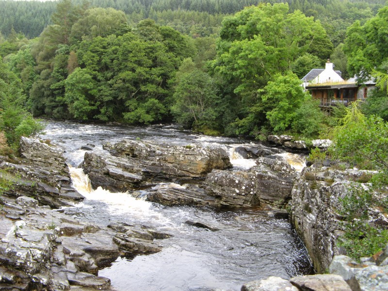
River Moriston Falls - is a waterfall located in the Glen Moriston area, near the village
of Invermoriston. The River Moriston is a river that flows through Loch Ness, one of Scotland's most
famous lochs, and the falls are a notable natural feature along its course. The River Moriston Falls is also
known as Invermoriston Falls or the Great Glen Waterfall. The falls consist of a series of cascades and
rapids, creating a picturesque and dramatic scene as the river descends over rocky ledges and flows through
a narrow gorge. The falls are surrounded by lush greenery and are often framed by trees and shrubs, adding
to their scenic beauty.
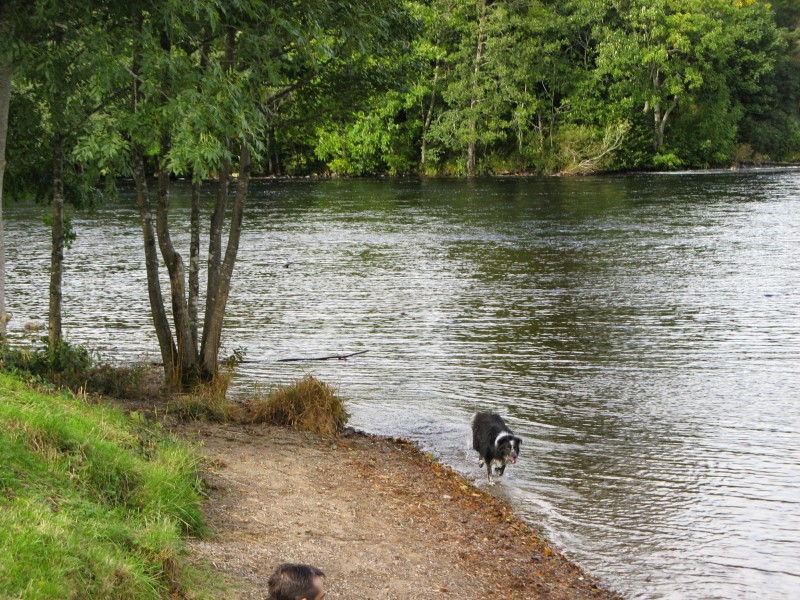
Loch Ness - the internet is full of information about the loch. It is most famously known
for the alleged sightings of the Loch Ness Monster, a mythical creature often described as a large,
long-necked dinosaur-like creature that is said to inhabit the lake. However, we identified two additional
claims to renown for Loch Ness. The first is the worst kebab we've ever had. We bought them at a store close
below the road bridge. Never, ever, ever again. The second is a nose that hangs in the souvenir shop, asking
all buyers to use it on members of the Campbell clan.
Inverness - the administrative center of the Highland Council area and is often
referred to as the 'capital of the Highlands'. It is known for its rich history, stunning scenery,
and vibrant culture. Inverness is situated at the northeastern end of the Great Glen, a large geological
fault line that stretches across Scotland. The city is located on the northeast coast of Scotland, on the
north shore of the Moray Firth, a large inlet of the North Sea. Inverness has a long history that dates back
to at least the 6th century. It has been a site of strategic importance since ancient times and has been the
site of many battles and conflicts throughout history, including the famous Battle of Culloden in 1746.
Today, Inverness is a modern city with a mix of historic and contemporary architecture.
Day 07
We left Inverness early in the morning in order to catch an early boat from John
O'Groats to Orkney Island.
John O'Groats is often considered the northernmost point of mainland Great Britain,
although nearby Dunnet Head is actually about 2 miles further north. It took us just over an hour to cross
the Gills Bay and dock at the St Margaret's Hope ferry terminal. Our tour guide then
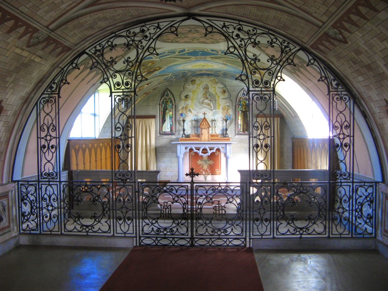
took us to Lamb Halm to see the Italian Chapel - a remarkable piece of
architecture located on the Orkney Islands, Scotland. It is a Catholic chapel that was constructed by
Italian prisoners of war during World War II, who were held captive on the island of Lamb Holm. The chapel
was built between 1943 and 1945 using two Nissen huts, which were linked together to form a single space.
The interior of the chapel was then decorated by the prisoners, who used whatever materials
they could find, including concrete, plaster, and scrap metal. Churchill Barriers was our next visit before
arriving in Kirkwell, Orkney's largest town. Churchill Barriers - are
a series of causeways, built during World War II to protect the Royal Navy's fleet anchorage at Scapa
Flow from submarine attacks. The barriers were named after the British Prime Minister, Winston Churchill,
who ordered their construction following the sinking of HMS Royal Oak by a German U-boat in 1939.
Kirkwell - Kirkwall is the largest town and capital of the Orkney Islands. It has a
population of around 9,000 people and is situated on the mainland of Orkney, which is connected to other
islands in the archipelago by a series of causeways and ferries. The town has a rich history, dating back to
Norse times, and is home to several historic landmarks and attractions, including:
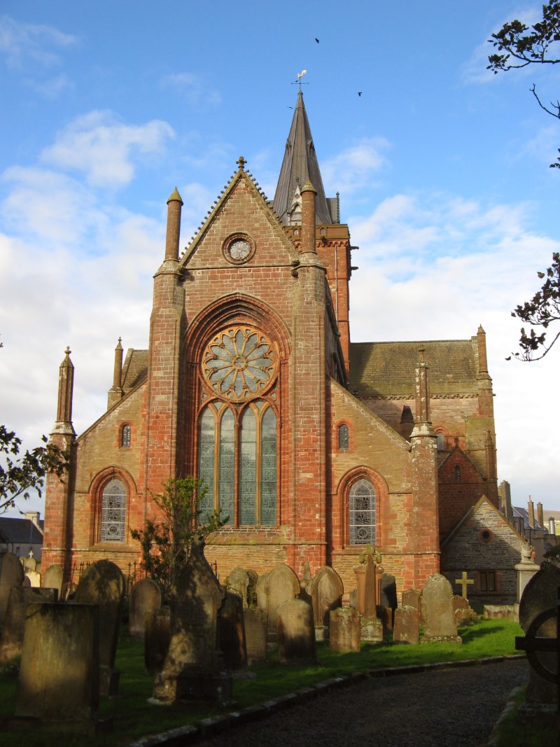
St. Magnus Cathedral - a historic landmark named after Magnus Erlendsson, Earl of Orkney,
who was killed in 1117 and later canonized as a saint. Construction of the cathedral began in the 12th
century, shortly after Magnus' death, and it was completed in the 13th century. It is an impressive example
of Romanesque architecture, with Gothic elements added in the 14th and 15th centuries.
Earl's Palace - a historic ruin of the palace built in the 16th century for the Earl
of Orkney, Patrick Stewart, who was a half-brother of Mary Queen of Scots. The palace was designed to be a
grand residence and a symbol of the power and status of the Earls of Orkney.
Bishop's Palace - a ruined palace located in Kirkwall. It was built in the mid-12th
century for the Bishop of Orkney and served as a residence and administrative center for the bishopric until
the Reformation in the 16th century. The palace is a significant historic site. It features the remains of a
great hall, a chapel, and a kitchen, among other rooms.
Day 08
We stayed in a B&B in Kirkwell that was connected to St. Magnus Cathedral. At breakfast, our hosts
converse
among themselves in a local dialect that we can not understand. And when they shifted to addressing us in
Scottish English, the outcomes were not much better.
After breakfast, we proceeded to a square near the Cathedral to meet other travellers and continue our
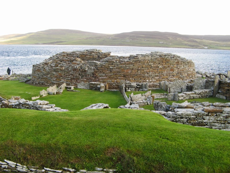
exploration of the Orkney Islands. The first stop on our itinerary was Broch of Gurness -
one of the best-preserved examples of a broch, which is a type of circular stone tower that was built in
Scotland during the Iron Age, constructed around 200 BC and was in use until around 100 AD, it is situated
on a headland overlooking Eynhallow Sound and was likely a center of power and prestige for the local
community.
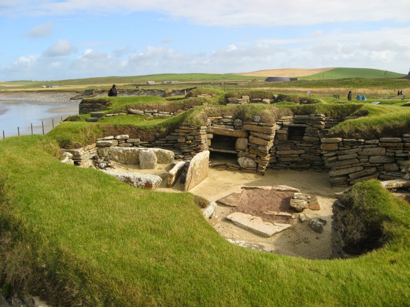
The next one was Skara Brae - Skara Brae was rediscovered in 1850 when a
severe storm hit the island, revealing a series of stone structures that had been buried under sand for
thousands of years. The site is remarkably well-preserved, and it provides an insight into the daily life of
the people who lived there more than 5,000 years ago. The settlement consists of a series of interconnected
dwellings, which were built from local sandstone and were probably covered with turf roofs. The dwellings
are small and cramped, with low doorways and no windows, suggesting that they were designed to be warm and
cozy, but also to provide protection from the harsh weather.
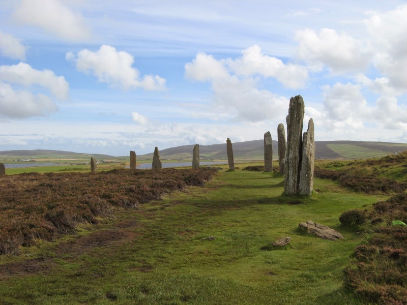
Another major stop on our journey was Ring of Brodgar - a Neolithic stone circle that
consists of 27 standing stones, with an additional stone lying in the center of the
circle. The stones range in height from 2.1 to 4.7 meters (7 to 15 feet) and are arranged in a perfect
circle measuring about 104 meters (341 feet) in diameter. The stones were likely quarried from a nearby
location and transported to the site using sledges and rollers. The purpose of the Ring of Brodgar is still
unknown, but it is believed to have had a ceremonial or religious significance. Some theories suggest that
it may have been used for astronomical observations or as a site for rituals and gatherings.
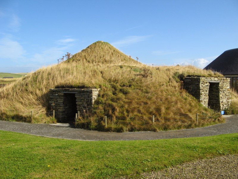
Next stop Maeshowe - a Neolithic chambered cairn built around
2800 BC, making it over 5,000 years old. The chambered cairn is made up of a circular mound of stones and
earth that measures about 36 meters (118 feet) in diameter and 7 meters (23 feet) in height. It is
surrounded by a ditch that is 4 meters (13 feet) deep and 15 meters (49 feet) wide. The cairn contains a
central chamber that is accessed by a passage. The chamber is made up of several compartments, and it
contains a number of carved stones and runic inscriptions.
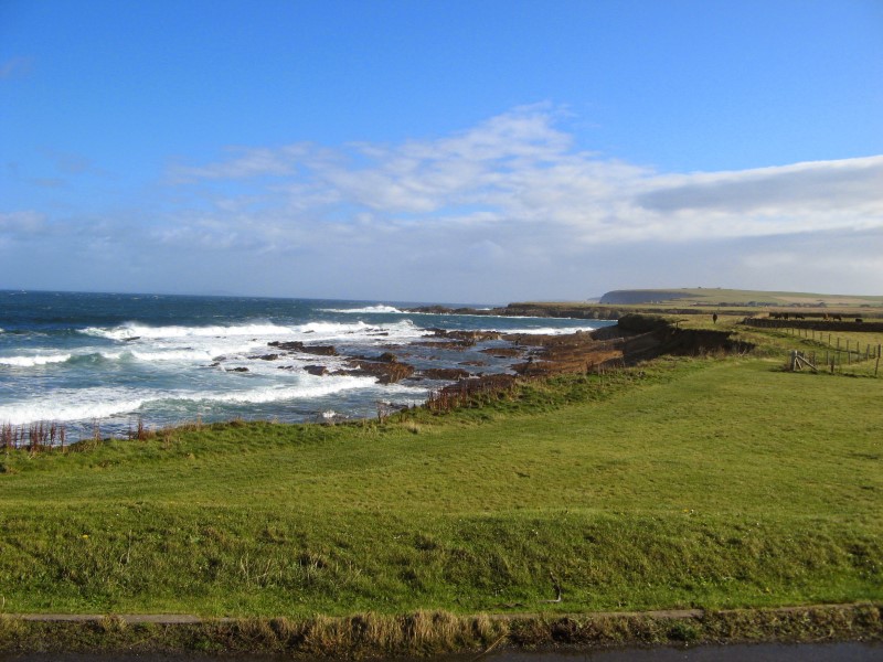
From Maeshowe we drove to Yesnaby - a coastal area located on the western coast of the
Orkney Islands. The area is known for its dramatic cliffs, sea stacks, and natural arches that have been
formed by the relentless action of the waves and wind over the centuries. Aside from its natural beauty,
Yesnaby is also steeped in history and folklore. The area is home to a number
of ancient ruins and archaeological sites, including the remains of a Neolithic chambered cairn, which dates
back more than 5,000 years. According to local legends, Yesnaby is also said to be the haunt of the mythical
sea creature known as the Nuckelavee, which is said to bring misfortune and disaster to anyone who
encounters it.
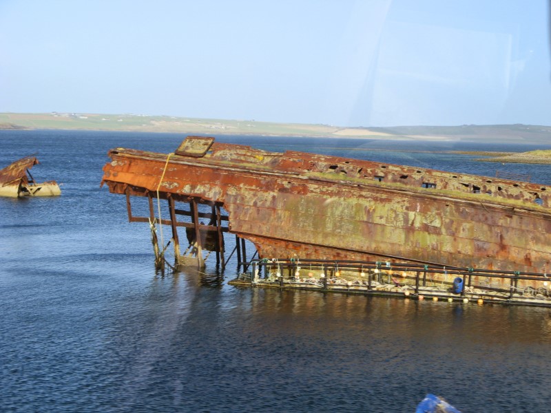
Scapa Flow Wreck was our final destination before heading back to Kirkwell.
The Scapa Flow Wreck refers to a number of ships that were scuttled in Scapa Flow. Scapa Flow was used as a
naval base during both World War I and World War II, and a number of ships were stationed there during those
periods. During World War II, Scapa Flow remained an important naval base, and a number of ships were
stationed there, including battleships, aircraft carriers, and submarines. On 14 October 1939, the German
U-47 submarine managed to infiltrate the base and sank the HMS Royal Oak, resulting in the loss of over 800
lives.
Day 09
It was time to say goodbye to the welcoming Orkney Islands and return to the mainland. It took us about ten
hours to travel three hundred km from Kirkwell to Ullapool. The day wasn't particularly thrilling;
except from stops at Smoo Vave and Knockan Crag, the majority of it was spent on the bus.
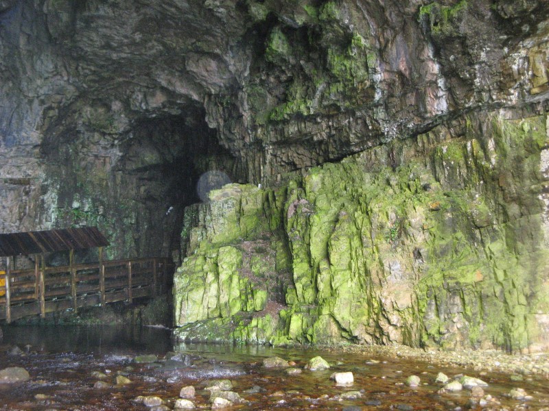
Smoo Cave is a limestone sea cave located near the village of Durness in
Sutherland. The cave is unique in that it has both freshwater and seawater passages, and it is the largest
cave of its type in Britain. The name "Smoo" is thought to come from the Norse word "smuga", which means a
hole or hiding-place. The cave has been used by humans for thousands of years, with evidence of human
habitation dating back to the Iron Age. It was also used as a smuggling den in the 18th and 19th
centuries.
Our Ullapool lodging was not your typical B&B. It was more of an old, run-down motel turned to a
B&B. Fortunately, the neighbourhood pub with wonderful food and live folk music rescued the day.
Day 10
After a somewhat uninteresting previous day, our final day with the Rabbie's was jam-packed with stops
at several intriguing locations. Before continuing on to Culloden we paused at Corrieshalloch
Gorge - a dramatic and steep-sided gorge around 1.5 km long and up to 60 meters deep in places.
At the head of the gorge is the 46-meter-tall Falls of Measach, which are one of the main attractions of the
area.
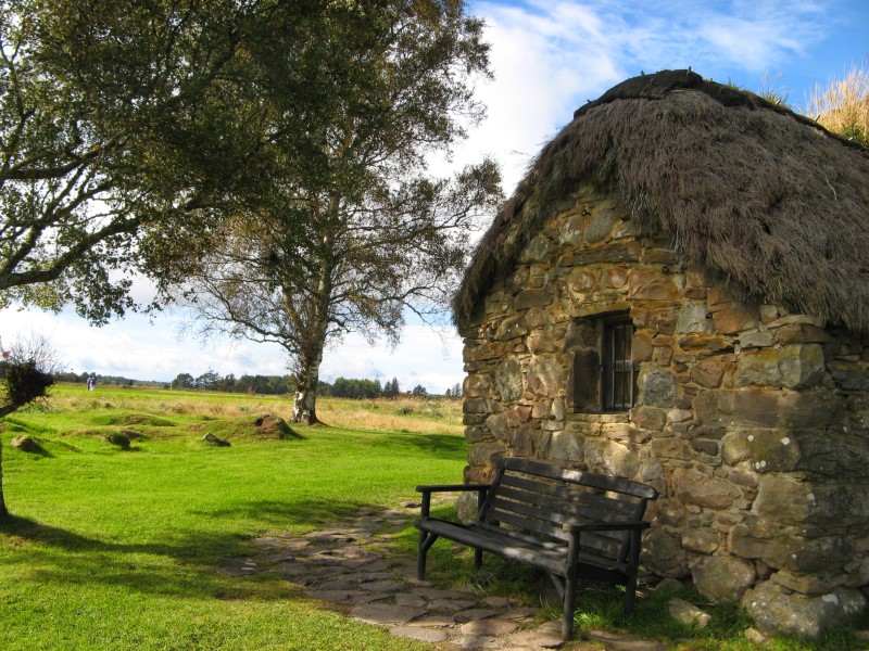
The primary draw of the day was a visit to the Culloden, where the Battle of
Culloden
took place. It was a significant battle fought on April 16, 1746, between the British government
forces and the Jacobite supporters of Charles Edward Stuart, also known as 'Bonnie Prince
Charlie.' The
Jacobite forces, made up of Scottish Highlanders and some French and Irish troops, were hoping to
overthrow the British government and restore the exiled Stuart dynasty to the throne. However, they were
outnumbered and outgunned by the government forces, who had more troops and advanced weaponry. The battle
lasted less than an hour and resulted in a decisive victory for the British government forces.
The Jacobites suffered heavy losses, with around 1,500 men killed or wounded compared to only around 50
casualties on the government side. Sorry Fiona.
Following that, we made brief stops at Clava Cairs and Aviemore, which had
wonderful views of the surrounding highlands, before touring Ruthven Barracks. The barracks
were built in 1719 by the British government in response to the Jacobite uprising of 1715, as a means of
controlling the Highland clans and preventing further uprisings. The barracks were designed to accommodate a
garrison of around 120 men and were built in a square shape with four corner towers. The walls are up to 6
meters high and were designed to withstand attack from small arms fire.
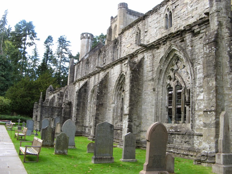
Our trip concluded with a quick walk around Dunkeld Cathedral and a stop at Forth Bridge.
Rabbie's took us on an incredible tour of Scotland. We met pleasant people, saw beautiful scenery, and
returned home with wonderful memories.

Day 11
We spent our final day in Scotland's capital touring through historic sections of town and noted some
of the most intriguing facts about Edinburgh. And now they're here:
•Edinburgh hosts the largest New Years Eve street party in the world! There’'s live music and an
awesome
fireworks display.
•
Every August thousands of tourists swarm the city for the Edinburgh Festival, which is composed of
several
different arts and cultural festivals.
•
J.K. Rowling penned the first novel in her Harry Potter series at the Elephant House cafe on George IV
Bridge.
•
'Caddies' were men who had to carry pales of water up to flats in Edinburgh.
•
Romantics believe Rose Street was named after the beautiful roses that grew on the slopes above the
North
Loch. This was not the case - as Rose Street was used to describe red-light districts of European towns.
Further, to 'pluck a rose' was a term used to describe picking up a prostitute.
•
In the 17th century, the citizens of Edinburgh believed that putting burnt ashes of dove's pooh on
their
head was a cure for baldness.
•
The Royal Mile is called this because it's a mile long street with two royal buildings on each end
-
Edinburgh Castle and Holyroodhouse Palace.
•
Edinburgh's nickname, Auld Reekie (Old Smoky), marks an era when the city's buildings and
homes burnt a
lot of coal and wood for heat and chimneys would emit columns of smoke into the air.
•
Edinburgh is said to be one of the most haunted places in Europe because it is home to the Mackenzie
Poltergeist, the violent spirit of a 17th century murderer and torturer who haunts Greyfriars Kirkyard.
•
One of the most photographed monuments in Edinburgh is Greyfriars Bobby, the statue of a 19th century
Skye
terrier who spent 14 years guarding his master's grave. Is sits at the corner of Candlemaker Row and
the
George IV Bridge.
•
From 1477-1911, the Grassmarket was the site of one of Edinburgh's main horse and cattle markets.
It was
also the location of public executions.
•
Back in the day when they threw their chamber pot contents into the street they didn't just do it
whenever. There was a special time when the bells from a certain church would ring and then everyone would
open up their windows, chamber pots in hand. Gardyloo would be yelled out and then splash into the street
it
would all go. Now the times that the bells tolled also happened to coincide with another time regulated
event, when the bars closed and the drunks came home. Apparently at this time there were a lot of
foreigners
in Edinburgh, trying to be protected from the English, so they weren't entirely accustomed to all of
Edinburgh's culture. When someone yelled gardyloo, instead of running and hoping to escape the splash
zone,
drunk and disoriented they would look up, and the phrase “shit-faced” was born.
Day 12
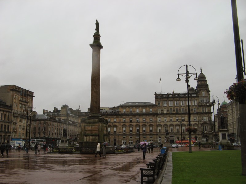
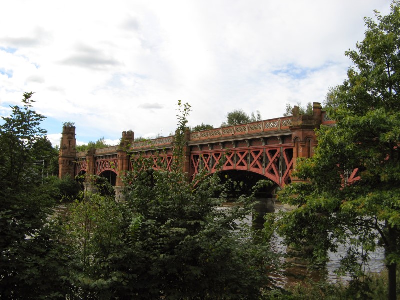
Early in the morning, we took one of the first trains to Glasgow from the nearby Haymarket Railway Station.
Soon after arriving at Queen Street Railway Station, we picked the walking path to our hotel at the top of W
Nile Street. After checking into the Holiday Inn Express, we ventured out to explore the main streets of
Glasgow. For change the wather was very kind to us and we spend few sunny hours exploring Glasgow. It is the
largest city in Scotland and the fourth-largest city in the United Kingdom. Glasgow has a rich history and a
vibrant cultural scene. The busy schedule allowed us a visit to the Glasgow Gallery of Modern
Art - a renowned contemporary art museum housed in a neoclassical building that was originally
built in 1778 as the townhouse of a wealthy tobacco merchant named William Cunninghame. The building later
served as the Royal Exchange and subsequently transformed into a gallery in 1996 to host GoMA's
collection.
One of the most prominent features of the museum is the statue of the Duke of Wellington located outside its
entrance. The statue is famous for its perpetually adorned traffic cone hat, which has become an iconic
symbol of Glasgow's sense of humor and rebellious spirit.
Last Day
We had a few hours to finish our sightseeing before taking the train to the airport and travelling to Poland
to visit family.
Our first stop of the day was to Glasgow Cathedral - also known as the High Kirk of Glasgow
or St. Mungo's Cathedral, is one of the most significant historical landmarks in the city. It is
located on Castle Street, on the eastern side of the city's medieval core. The cathedral's origins
can be traced back to the late 12th century when the patron saint of Glasgow, Saint Mungo, established a
small church on the site. Over the centuries, the building underwent several expansions and renovations,
resulting in its current Gothic architectural style.
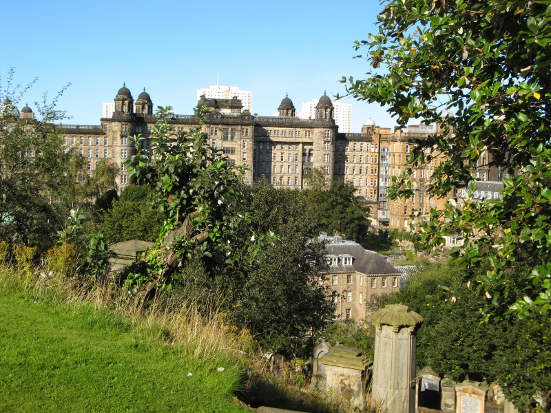
The nearby Necropoli - a Victorian cemetery that sits on a hill overlooking the city. It
contains elaborate tombstones, mausoleums, and monuments, and is the final resting place for many notable
Glaswegians. The cemetery was established in 1832 and was designed by renowned architect Alexander Thomson.
It was created to meet the growing demand for burial space in the city, as Glasgow's population was
rapidly
expanding during the Industrial Revolution. The design of the necropolis was influenced by the Père Lachaise
Cemetery in Paris and the Mount Auburn Cemetery in the United States.
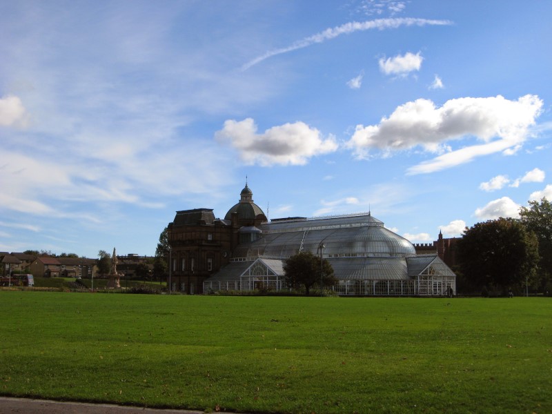
Our final destination on our short visit to Glasgow was People's Palace and its Winter
Garden - a popular museum and social history attraction. It is situated in Glasgow Green, the
city's oldest public park, on the eastern side of the city center. The People's Palace was opened
in 1898 and was originally built as a cultural and social center for the working-class people of Glasgow.
Its purpose was to provide a space for leisure activities, education, and community gatherings. The
building's design is notable for its impressive glasshouse structure, which allows ample natural light
to enter the museum. One of the highlights of the People's Palace is the famous "Benny's Café"
exhibit, which recreates a typical Glasgow tenement flat from the early 20th century. This immersive display
provides a glimpse into the living conditions and daily life of the city's working-class residents
during that time. Adjacent to the People''s Palace is the Winter Gardens, a Victorian glasshouse
that features a variety of exotic plants and flowers (some of them from New Zealand). It provides a peaceful
setting for visitors to relax and enjoy the beauty of nature.